
Project
Monitoring urban sociospatial development
Year
Country
CH

The Swiss Federal Office of Topography (swisstopo) would like determine the extent to which its national swissTLM3D database can be augmented to enable routing applications. Working on behalf of swisstopo, we identified and prioritized the necessary adaptations and defined a set of potential use cases before going on to develop a prototype to demonstrate the feasibility of the routing-enablement.
swisstopo has operated its «Topographical Landscape Model» (TLM) database since 2008. TLM maps more than 13 million landscape features, including buildings, transportation infrastructure, land cover, bodies of water and individual objects such as trees. All of the objects contained in the TLM are represented in 3D.
swisstopo uses this database as a source for various models, including the large-scale topographical landscape model known as «swissTLM3D». swissTLM3D encompasses a total of eight object categories, including the categories «Roads and Paths» and «Public Transportation».
swisstopo commissioned EBP to carry out a feasibility study to determine if the swissTLM3D database can be augmented to enable routing functionality. In particular, the aim of the study is to clarify the following issues:
The scope of EBP’s assignment also included the development of a functional prototype to demonstrate routing capability.
The first phase of the study centered on establishing clear definitions of the terms «Routing», «Trip Routing» and «Analysis Routing» and identifying a set of common use cases. We then used these use cases to specify the geometric-topological, attribute-specific and superordinate requirements that would need to be met by a routing-capable database for use in connection with private motor vehicles, public transportation, bicycle traffic and pedestrian traffic. We also characterized the requirements in terms of their importance and their expected temporal dynamics.
The second phase of the study centered on a detailed analysis of the data structure, the data model as well as the capturing and updating guidelines for the «Roads and Paths» and «Public Transportation» categories in swissTLM3D. Using this analysis as a basis, we then matched the previously specified requirements to the existing data as a means of identifying requirement gaps.
Using the Business Model Canvas (BMC) approach, EBP examined and evaluated possible routing services together with the client and provided an overview of existing routing services and prospective future applications. The BMC method was used to ascertain and subsequently combine a total of seven solution components (including use cases, services and resources). EBP used this approach to develop a set of four solution proposals for further consideration. One of the four was then selected for continued development and implementation.
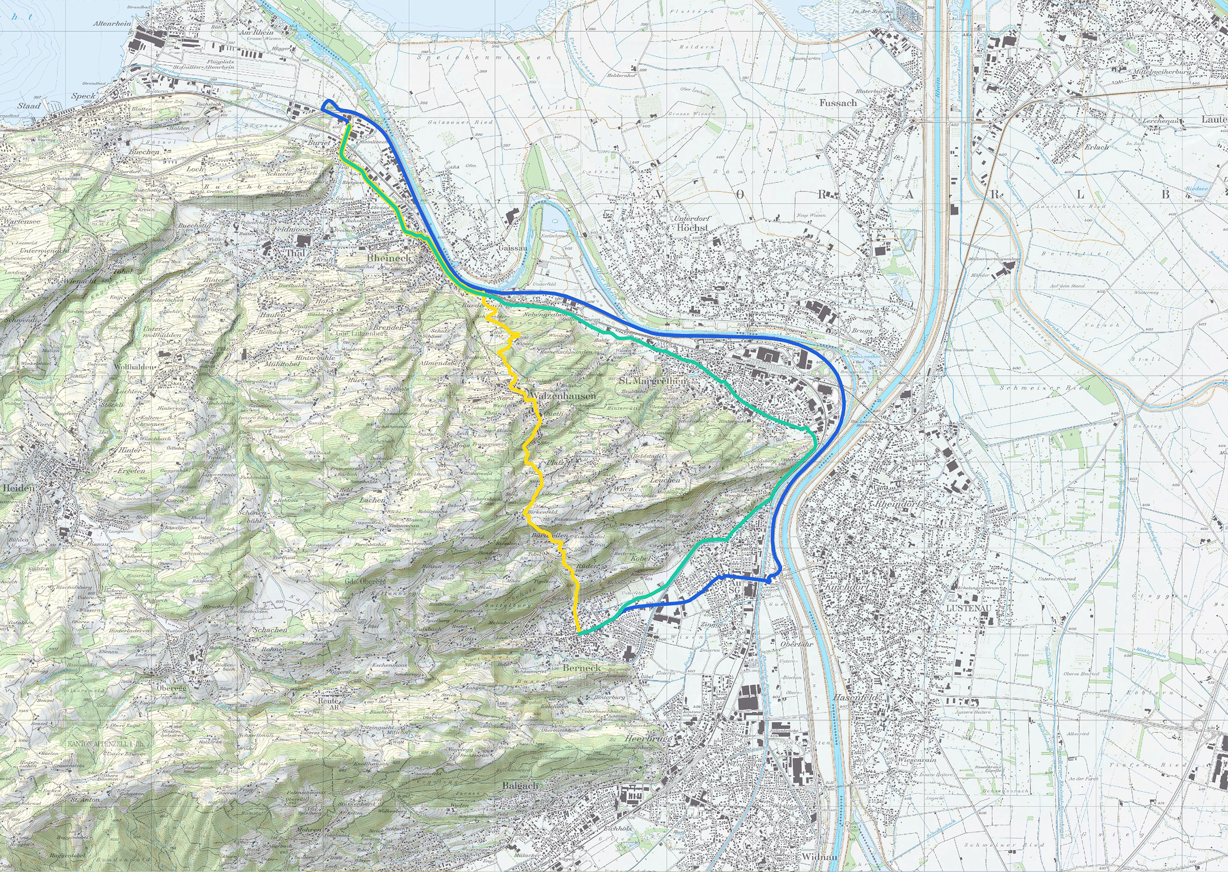
In addition to this conceptual work, EBP used an excerpt of swissTLM3D in Eastern Switzerland to develop a proof-of-concept application to demonstrate routing capability. This application includes the various necessary functions, provisions for cross-border routing capability and proposals for managing the previously determined need for data augmentation.
The feasibility study concludes with recommendations for the further development of the selected solution. It is accompanied by comprehensive technical documentation of the realized prototype.


